“So This Is Dyoublong?
Hush! Caution! Echoland!
How charmingly exquisite! It reminds you of the outwashed engravure that we used to be blurring on the blotchwall of his innkempt house. Used they? (I am sure that tiring chabelshoveller with the mujikal chocolat box, Miry Mitchel, is listening) I say, the remains of the outworn gravemure where used to be blurried the Ptollmens of the Incabus. Used we? (He is only pretendant to be stugging at the jubalee harp from a second existed lishener, Fiery Farrelly.) It is well known. Lokk for himself and see the old butte new. Dbln. W. K. O. O. Hear? By the mausolime wall. Fimfim fimfim. With a grand funferall. Fumfum fumfum.”
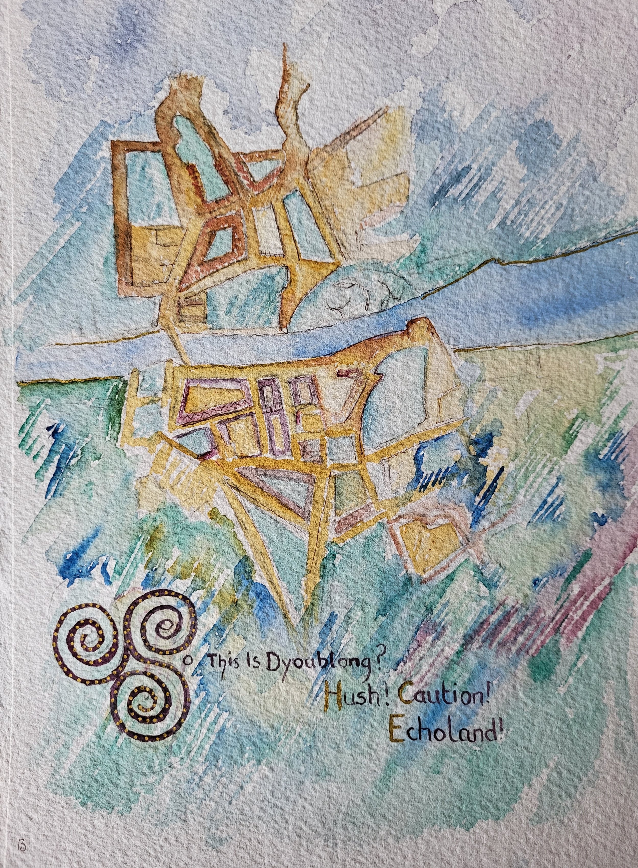
Historic ordinance survey maps provided the background for this illustration, and they were to shape many subsequent works. This version was based on the 1888-1913 OSI map, but missing from it are the place names and the river. The only points of reference are the Phoenix Park on the northside and the Inchicore Railway Works on the southside. By removing its most identifying features, I intend to both defamiliarise and generalise the location. After all, do we need to have all the map references to know if we belong? By removing the place names, too, I have stripped back layers of history from the map, and we move one step closer to the landscape where our ancestors walk.
Beneath the landscape, I have depicted layers of vegetation to represent remnants of the lives of previous inhabitants and the way in these lives become part of the ground on which we stand and the plant life that grows around us.
Page 13 describes a "grand funferall," so in the theme of fun and games at the Wake, we have a challenge for you. In the area of the map that indicates the location of the Phoenix Park—where the feet of Fionn Mac Cumhaill are buried—are symbols from ancient Irish burial sites, dating as far back as Neolithic times. Can you identify them?